Monitoring Water resources in Red River Basin using Microwave Remote Sensing
Hydrological data on major rivers, lakes and wetlands can often be difficult to obtain due to a region’s inaccessibility, sparse distribution of gauge stations or the slow dissemination of data. Remote sensing technologies can be used to overcome such shortcomings.
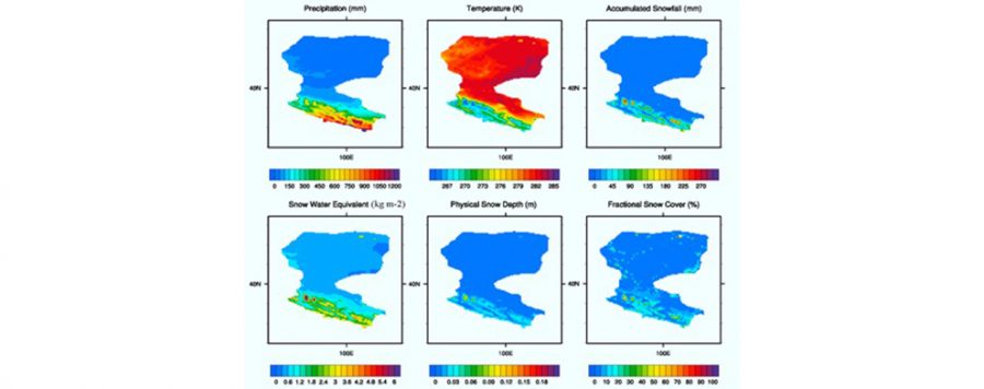
The main objective of this project, funded by Dragon-4, a program cooperation between ESA and the Ministry of Science and Technology (MOST) of China, was to develop the algorithms and synergies between different Microwave Remote Sensing sensors to be able to monitoring water resources in the Red River Basin. For that purpose, the water elevation information, precipitation, soil moisture and evapotranspiration by remote sensing have been integrated in a hydrological model to improve its accuracy.